milnerton south

Milnerton South Framework - Milnerton, Cape Town - 2016

Client: City of Cape Town

Milnerton South from the N1 to Loxton Road including Paarden Eiland, Rugby and Brooklyn is a fast changing area that required a visionary development framework to guide the future.

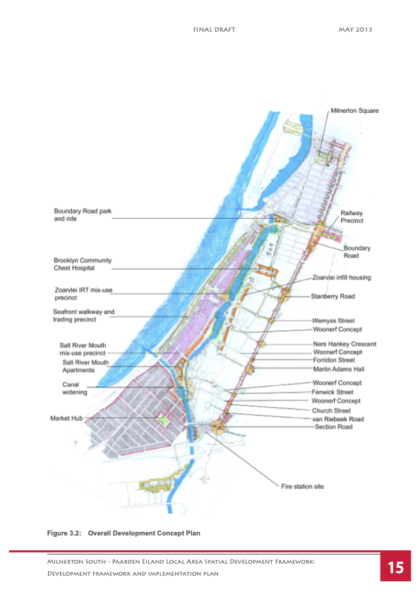
A detailed development concept plan map of Milnerton South with streets, residential areas, parks, a canal, and key sites labeled, including a fire station, marketplace, and various housing and recreational precincts.
Map showing strategic precincts in Milnerton South, including land parcels, canal, market hub, fire station, hospital, residential and park areas, railway, and specific precincts labeled from 1 to 12, with a legend indicating different land uses and features.
Map of a development plan for the Stirling area showing color-coded zones, landmarks, and infrastructure features with a list describing proposed development projects, including residential spaces, public squares, transportation stations, and building examples.
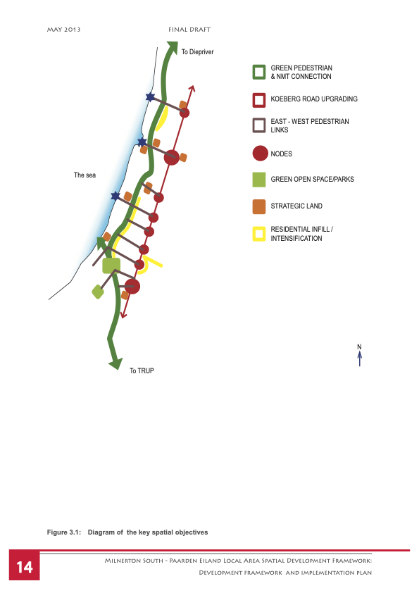
Diagram of the key spatial objectives for the Milnerton South area, showing different land uses: green open spaces, strategic land, residential infill, pedestrian links, and connections to other areas, with color coding and directional arrows.